Appendix 3 - Washoe County Maps
Figure 9 Washoe County Boundary. Source: Washoe Regional Mapping System (washoecounty.us)
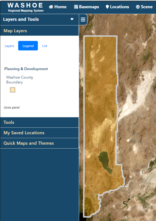
Figure 10 Unincorporated Washoe County (shaded brown), Reno (shaded pink), Sparks (shaded green). Washoe Regional Mapping System (washoecounty.us)
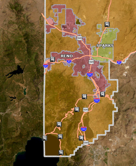
Figure 11 Regional Jurisdiction map, Reno-Sparks metro area. See full legend in Figure 12 below Source: Truckee Meadows Regional Planning Agency (TMRPA)
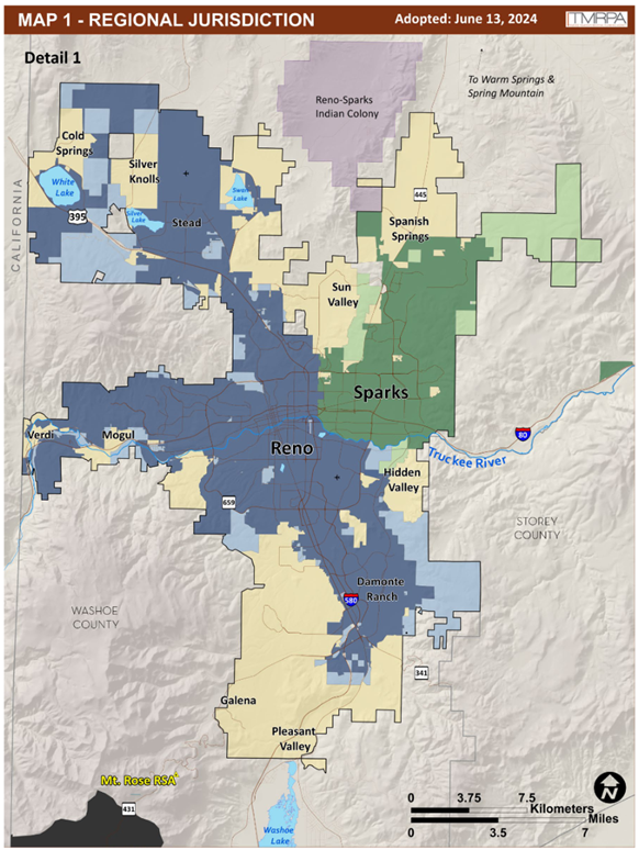
Figure 12 Regional Jurisdiction map, full County and legend. Source: Truckee Meadows Regional Planning Authority (TMRPA)
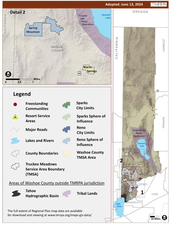
Figure 13 Map showing concentration of Hispanic Latino population in Washoe County. Lemmon Valley, Sun Valley, Sparks, Hidden Valley, and Pleasant Valley-- shaded in aqua--have the highest percentages of Hispanic Latino populations in our region. (Source: ArcGIS map from the Latino Research Center at the University of Nevada, Reno)
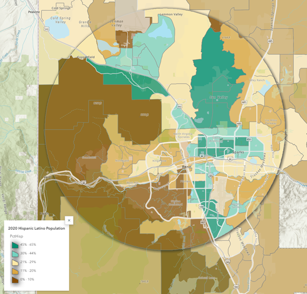
Figure 14 Map of land use types in Washoe County. Mixed Use Core is the highest density land in the County. Source: Truckee Meadows Regional Planning Agency, page 65

