What Occurred?
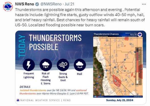
 According to the National Weather Service, Reno, two thunderstorms collided over the Hidden Valley area, quickly forming a powerful new storm. This led to heavy rain and hail, especially near Hidden Valley and along Veterans Parkway. Radar signature for heavy rain was near and over steep terrain, but lack of real time observations (e.g. Alert gauge) made for a difficult assessment of how much rainfall was reaching the ground. A Flood Advisory was issued at 5:27 pm, followed by a Severe Thunderstorm Warning at 5:30 p.m., giving about 30 minutes of lead time before the first impacts were felt around 6 p.m.
Unfortunately, this type of fast-forming storm is nearly impossible to predict with enough time for people to take preventative measures. We can forecast when conditions are in place for storms to develop, but not specifically where outflows may collide and initiate a new storm, such as what happened in this case. This storm could have caused similar flooding anywhere in the Reno-Sparks area, regardless of proximity to a river.
One citizen weather observer in the storm’s path provided data that matched a rare 200-year rainfall event, meaning there's only a 0.5% chance of such an intense storm occurring in any given year. However, this data wasn't part of the official network, so it wasn't easily accessible in real-time.
The storm’s impact was further complicated because it occurred over an alluvial fan—an area prone to unpredictable flooding due to its shape and loose soil deposits, which can create unpredictable flow paths.
Levels of Flood Warnings
- [Flash] Flood Watch: Be prepared. A flood watch is issued when conditions are favorable for
flooding/flash flooding, ~50% confidence. This is done by zone, or large geographical area. The
“set” stage in EM parlance.
- Flood Advisory: Be Aware. Issued when flooding may cause significant inconvenience, and if
caution isn’t exercised, it could lead to situations that threaten life/property. ~80% confidence.
This is done on a storm scale, or smaller area.
- Flash Flood Warning: Take Action Now (the “go” stage). Issued when flash flooding is
imminent or occurring. This is a sudden, violent flood and often life or property threatening. This
is done on a storm scale, or smaller area. ~80% confidence. Triggers an Emergency Alert (EAS) on weather
radio for all Flash Flood Warnings and a Weather Emergency Alert (WEA), or cell phone alert, but only IF a “considerable” or “catastrophic” tag is noted.
- Base: No Tag. Most frequently used. Standard Flash Flood conditions.
- Considerable: Use rarely. Flash flooding capable of unusual severity. Urgent action
needed to protect life and property. - Catastrophic: Very rare. Considered a Flash Flood Emergency. Flood waters have risen
or will rise to levels rarely, if ever, seen.
